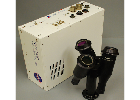
Navigation Doppler Lidar Sensor Demonstration for Precision Landing on Solar System Bodies
PI: Farzin Amzajerdian, NASA/Langley Research Center
PI: Farzin Amzajerdian, NASA/Langley Research Center

- TA04 Robotics, Tele-Robotics and Autonomous Systems
- TA09 Entry, Descent and Landing Systems
The Doppler lidar will begin its operation during the powered descent phase from an altitude of a few kilometers above the ground. The GN&C system processes the lidar data to improve the vehicle position data from the Inertial Measurement Unit (IMU) that after long travel time from Earth are grossly inaccurate by hundreds of meters. The improved position knowledge along with the lidar precision vector velocity data enables the GN&C system to continuously update the vehicle trajectory toward the landing site. In addition to the precision trajectory determination, the lidar data will play important role in performing the soft landing maneuver.
Flight demonstrations on the Masten sRLV will raise the TRL of the NDL from 5 to 6, and serve as a major step toward providing the NDL as a standard landing sensor. The sRLV flights will demonstrate the capabilities of the NDL for future landing missions and gain the confidence of the mission designers in this advanced technology.
This flight demonstration will reduce the risk of using the advanced Doppler lidar technology for future landing missions that may be launched as early as 2017 and certainly for recently-announced Mars rover launch in 2020. The flight demonstration will familiarize the potential users with the Doppler lidar measurements and gain the confidence of mission designers.
Technology Details
-
Selection DateAFO6 (Jun 2013)
-
Program StatusCompleted
- 2 sRLV
Development Team
-
PIFarzin Amzajerdian
-
Organization
-
SponsorNASA/Langley Research Center
-
More Information

